
What Is LiDAR Mapping and Why Does It Matter for Your Project?
11/3/2025
introduction
When it comes to land surveying and site planning, precision is everything. Whether you're developing land, planning infrastructure, or analyzing large properties, traditional surveying methods can be slow, expensive, and prone to errors. That’s where LiDAR mapping comes in — a cutting-edge solution that delivers fast, accurate data from above.
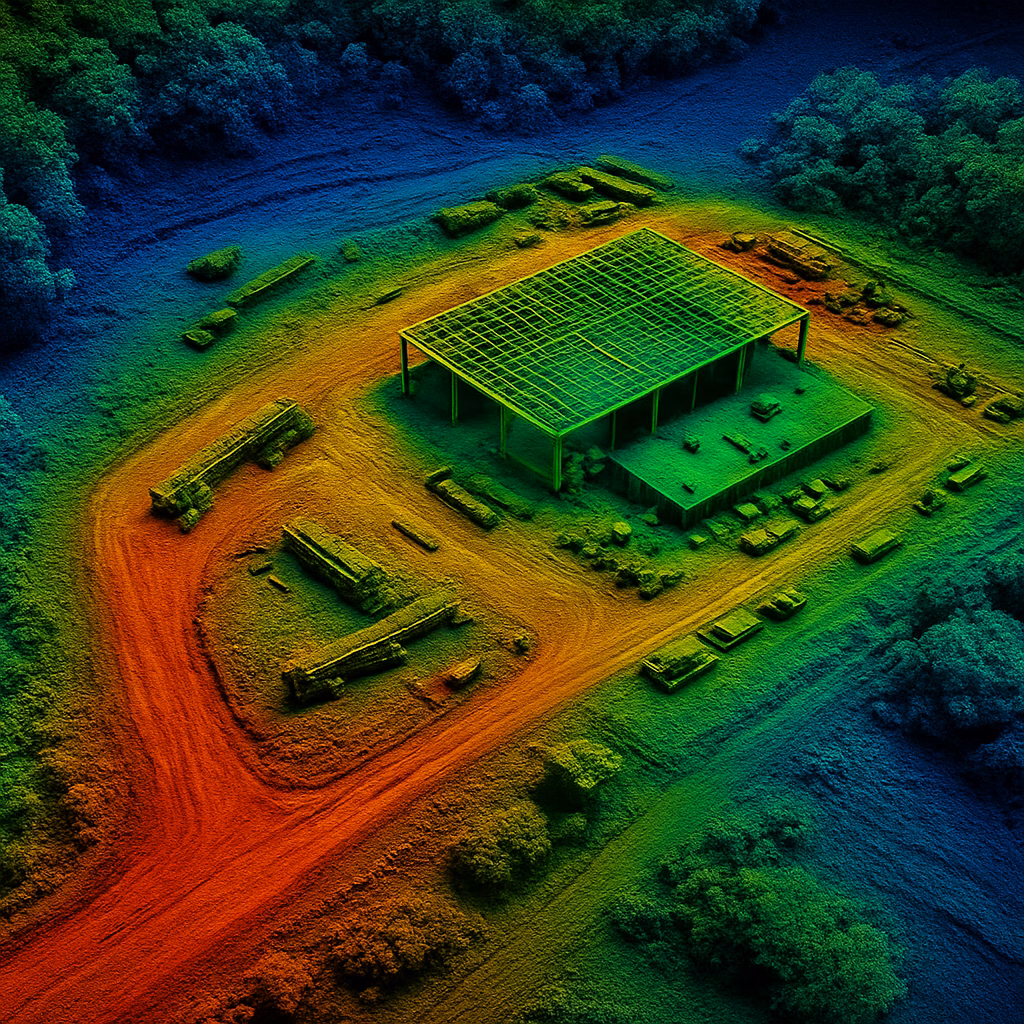
What Is LiDAR Mapping?
LiDAR stands for Light Detection and Ranging. It uses laser pulses from an airborne drone to measure distances to the ground, creating high-resolution 3D maps and elevation models. These data-rich maps allow construction firms, surveyors, and land developers to get a clear and precise view of terrain — even through vegetation.
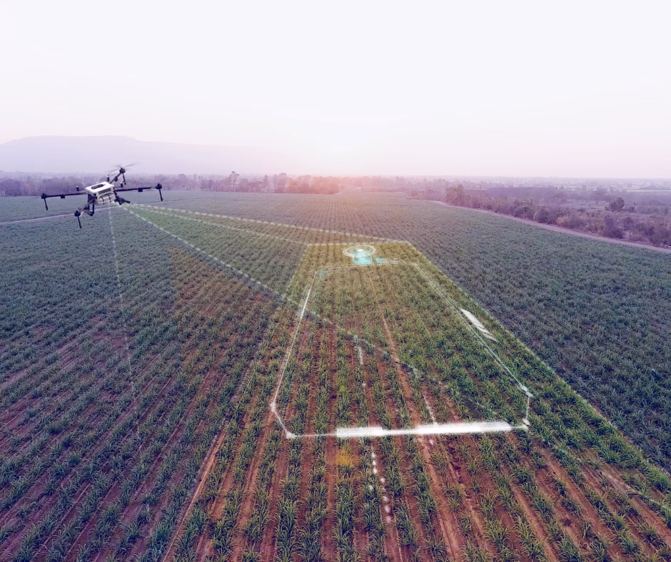
How SkyHound Uses Drone LiDAR Technology
At SkyHound, we combine drone mobility with advanced LiDAR sensors to scan large areas quickly and accurately. Our LiDAR mapping process includes:
- Site Planning: We evaluate your property and determine flight parameters based on your goals.
- Aerial Data Capture: Our FAA-licensed pilots collect LiDAR data with millimeter-level accuracy.
- Data Processing: We generate 3D point clouds, contour maps, and elevation models tailored to your project.
- Actionable Deliverables: Receive CAD-ready files, digital terrain models (DTMs), and georeferenced maps compatible with GIS and engineering software.
Who Needs LiDAR Mapping?
LiDAR is ideal for projects where elevation, slope, or terrain matter. You may benefit from SkyHound’s LiDAR services if you’re involved in:
- Construction & Site Development – Reduce delays by starting with accurate terrain data.
- Civil Engineering & Infrastructure – Support permitting, grading, and road planning.
- Surveying & Mapping – Replace or supplement ground-based surveys for faster turnaround.
- Environmental Management – Analyze erosion, watershed flow, or vegetation canopy.
Why Choose SkyHound for LiDAR Mapping?
- Fast Turnaround: We deliver results in days, not weeks.
- High Accuracy: Our drone LiDAR is capable of sub-10cm vertical accuracy.
- Local Expertise: Based in Virginia, we specialize in regional regulations and terrain.
- Fully Managed: From planning to final maps, we handle every step for you.
Get Started with LiDAR Mapping Today
If you’re planning a project that depends on land accuracy, don’t rely on outdated tools. Contact SkyHound today to learn how our LiDAR mapping services can save you time, money, and headaches.
other related articles


Get Your Own Drone – Elevate Your Capabilities
Take your operations to the next level with the latest in drone technology. Whether you're looking to capture high-quality aerial data, enhance your workflow, or explore new opportunities, we’ve got the perfect drone for you.