Construction Mapping
Elevate your construction projects with drone-powered mapping, drone surveying, and progress tracking, delivering accuracy and efficiency from start to finish.


Drone Construction Mapping Services
Accurate Construction Site Mapping & Surveys
Enhance project planning with high-resolution drone mapping, providing precise topographical data and 3D modeling for construction sites.
Real-Time Progress Monitoring
Track construction phases with aerial imaging, ensuring quality control, safety compliance, and improved project timelines.
Volumetric Measurements & Stockpile Analysis
Measure materials, assess cut-and-fill calculations, and track inventory with drone-based volumetric scans, reducing costly miscalculations.
Benefits of Construction Mapping Drone Services
Revolutionizing construction planning and site management, our advanced drone mapping and surveying solutions save time, reduce costs, and enhance safety on every project.
55%
60%
60+
Precise Construction Mapping with Drone Technology
Get high-accuracy mapping, volumetric scans, and site monitoring to keep your projects on track. Contact us today for a customized drone service quote.
why you should choose us
At SkyHound, we redefine drone data collection with advanced drone technology that delivers faster, more accurate, and cost-effective results. Unlike traditional construction mapping methods, our approach eliminates inefficiencies, reduces labor costs, and provides real-time insights that help businesses make better decisions.
Traditional Methods

SkyHound Drones Difference

How It Works
Elevate your project’s construction mapping efficiency with high-accuracy drone mapping, site monitoring, and volumetric analysis for better planning and faster decision-making.
01.
Project Assessment
We discuss your site needs and select the best drone solutions for construction mapping, progress tracking, or volumetric analysis.
02.
Aerial Survey & Data Capture
Drones conduct high-accuracy scans, collecting topographical, structural, and environmental data.
03.
Data Processing & Reports
We convert drone data into detailed maps, 3D models, and analytics for informed decision-making.
04.
Implementation & Updates
You receive easy-to-use reports and ongoing support, keeping your project on track and optimized.
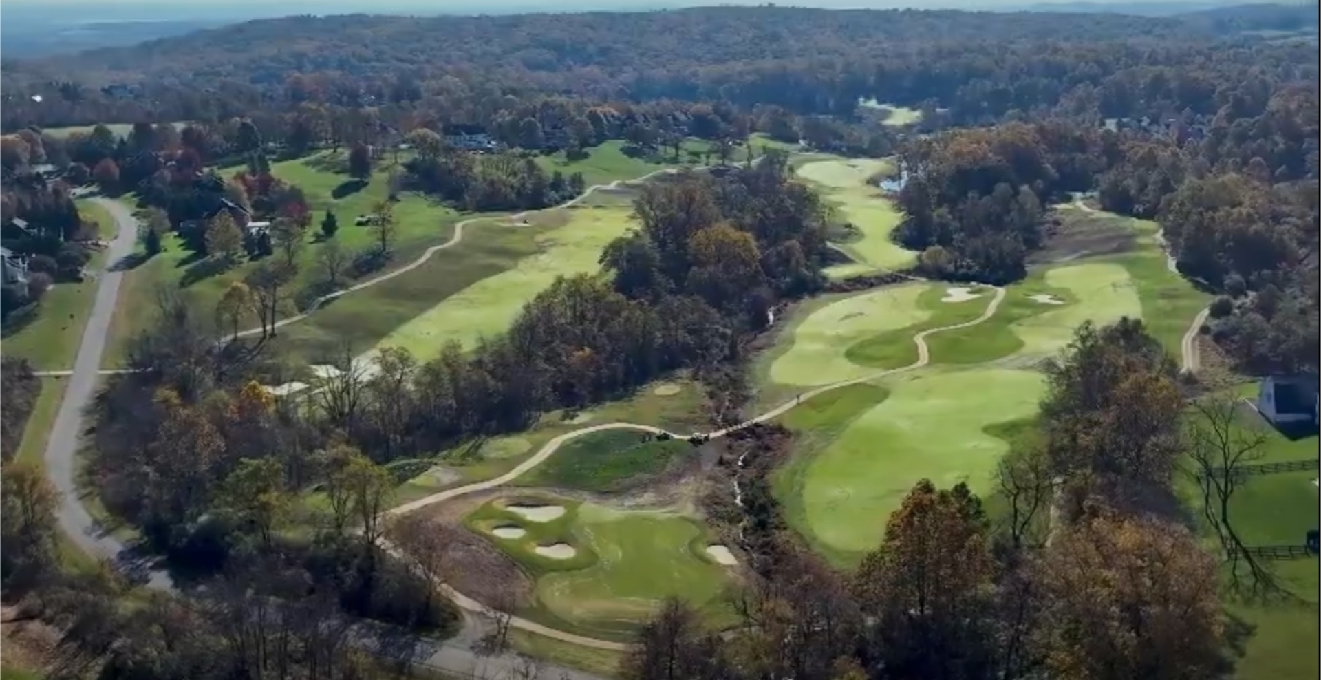
See How We Helped These Companies Succeed
Featured Case Study title will Go over Here
Lorem ipsum dolor sit amet, consectetur adipiscing elit. Suspendisse varius enim in eros elementum tristique. Duis cursus, mi quis viverra ornare, eros dolor interdum nulla, ut commodo diam libero vitae erat.
220K
Lorem ipsum dolor
175
Lorem ipsum
10K
Lorem ipsum dolor
Featured Case Study title will Go over Here
Lorem ipsum dolor sit amet, consectetur adipiscing elit. Suspendisse varius enim in eros elementum tristique. Duis cursus, mi quis viverra ornare, eros dolor interdum nulla, ut commodo diam libero vitae erat.
220K
Deer recoveries completed
175
Acres mapped
10K
Of acres flow for agriculture clients
why we’re the best at providing Drone data technology solutions
SkyHound delivers cutting-edge drone data solutions tailored to construction, agriculture, outdoor management, and media industries. With advanced technology, precision-driven results, and a commitment to efficiency, we help businesses streamline operations, reduce costs, and gain critical insights from above.
Unmatched Expertise in Restricted Airspace
Operating in DC, Maryland, and Virginia, we specialize in navigating FAA regulations and restricted airspace, ensuring compliant and seamless drone operations.
Precision Crop Spraying & Land Analysis
SkyHound's drone-based spraying and deer herd analysis help farmers and landowners optimize yields, reduce chemical waste, and improve herd management with cutting-edge aerial insights.
Search & Recovery Solutions with Thermal Imaging
Our thermal drone technology assists in wildlife tracking, deer recovery, and search operations, ensuring rapid, accurate results even in challenging terrain.
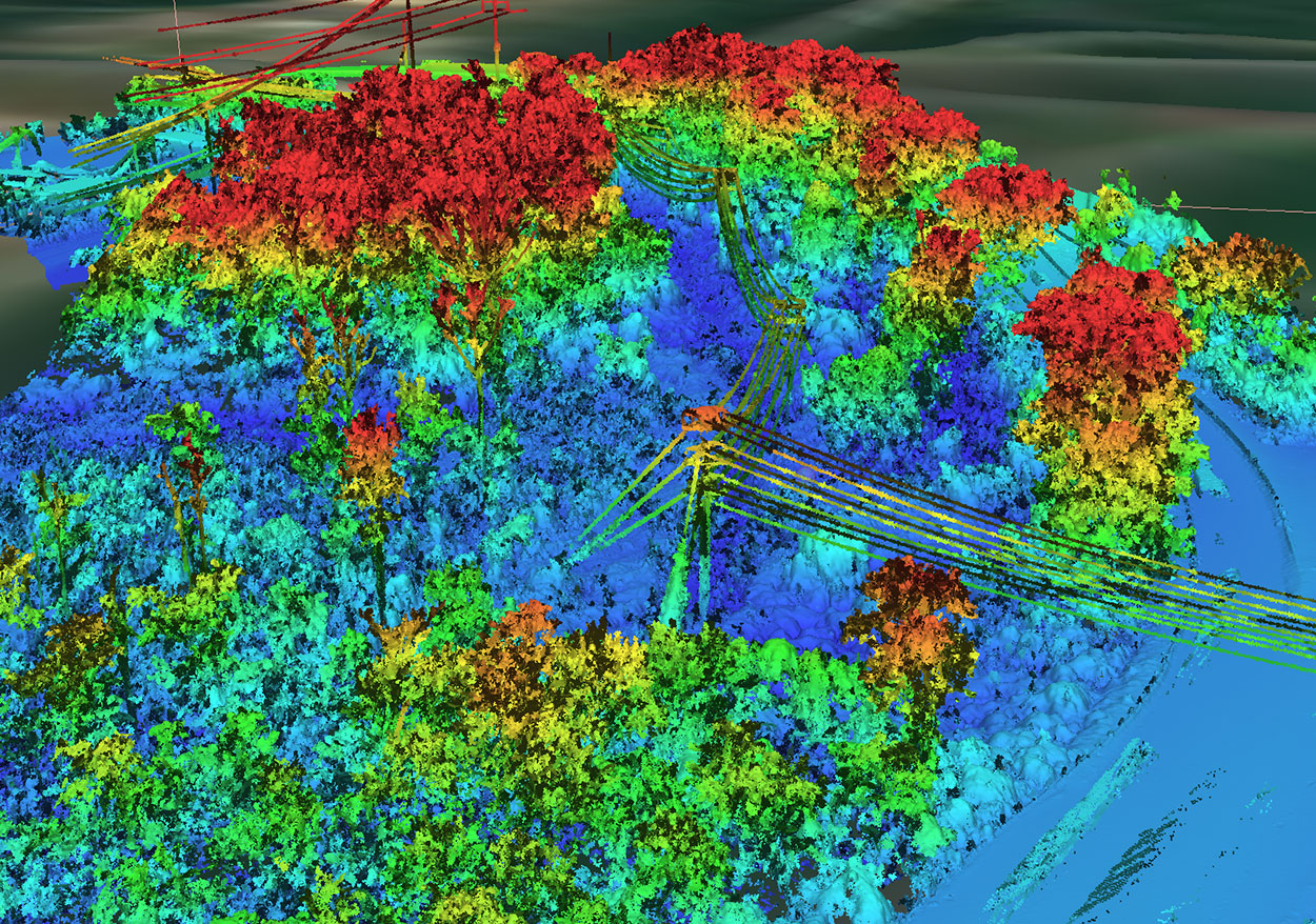
Advanced LiDAR & 3D Mapping Capabilities
Our LIDAR and orthomosaic mapping deliver highly accurate topographical data for construction, infrastructure planning, and environmental assessments.
Reliable Data for High-Stakes Projects
From construction site progression tracking to stockpile scans, our drone solutions provide reliable, data-driven decision-making for projects of all sizes.
Industry-Tailored Media & Aerial Videography
With years of experience in cinematic drone capture, we provide high-impact aerial footage for marketing, real estate, and outdoor adventure media.
hear from our clients
I shot a buck with a crossbow and didn’t have luck finding it. I called Tyler and he was out within hours!!! We searched 10X what I could do on foot and with no disturbance to other deer. We were unfortunately not able to recover the deer but it was nice to know I did everything I could to recover it and that it may survive. 1000% recommend this service.
- Eric Rutt
Had a great experience with Sky hound with their deer recovery service. They had a very rapid response and was able to make it to me right away. They have top of the line equipment and the customer service was unmatched.
- Andrew Berry
SkyHound, my next-door neighbor, so I know Tyler and trust him, did a fantastic job of thermal-assessment of my 1899 colonial, that will help me improve my house's thermal integrity. I highly recommend SkyHound!
- Jeffrey Phillips
Tyler has great drone experience and is a wonderful guy as well. He will do quality work for you
- Spencer Burns
I’ve been hunting for 50 years and have regretfully not found deer that I hit with my bow. This year I used SkyHound the day after shooting a deer an was unable to find it. The SkyHound guys found it in 20 minutes. I’m a SkyHound believer!!
- Dale D'Alessio
Incredible images and customer service! I would highly recommend.
- Kelly Clifton
Take Your Business to New Heights with SkyHound
Unlock the power of precision drone data to optimize your operations, cut costs, and gain a competitive edge. Schedule a consultation today and see how SkyHound can elevate your business.
Construction FAQs
Got questions? We’ve got answers. Here are the most common inquiries about our drone services and how we can help your business leverage cutting-edge aerial technology.
01.
How do drones improve construction site surveys?

01.
Drones collect high-resolution mapping data faster than traditional surveying methods, reducing time and labor costs.
02.
Can drone mapping be used for both residential and commercial projects?
02.
Yes, our drone technology is ideal for large-scale commercial developments and smaller residential construction projects alike.
03.
What is the accuracy of drone-based topographical mapping?
03.
Our drones use LiDAR and photogrammetry to provide centimeter-level accuracy for site planning and earthworks.
04.
Can drones track project progress over time?
04.
Absolutely! Our aerial progress tracking helps keep stakeholders informed, improves project coordination, and prevents costly delays.
05.
Are drone services compliant with construction safety regulations?
05.
Yes, our FAA-certified pilots follow all industry safety standards and regulations to ensure secure drone operations on-site.