Precision Ag: Using Drone Maps to Improve Crop Yields and Efficiency
11/3/2025
introduction
In today’s world of farming, doing more with less isn’t just a goal—it’s a necessity. From rising input costs to unpredictable weather, modern agriculture demands smarter strategies. That’s where precision ag comes in—and drones are playing a key role in making it work.
With drone mapping and aerial data analysis, farmers now have powerful tools to better understand their land, improve decision-making, and boost overall efficiency. Here’s how SkyHound’s drone services help bring precision agriculture to life.
What Is Precision Agriculture?
Precision agriculture (or “precision ag”) is a farming management approach that uses data and technology to optimize every inch of a field. Instead of treating every acre the same, precision ag helps farmers make informed decisions based on real-time, location-specific insights.
Drones, GPS, sensors, and software all work together to monitor crop health, soil conditions, water needs, and more—allowing you to reduce waste, lower costs, and improve yields.
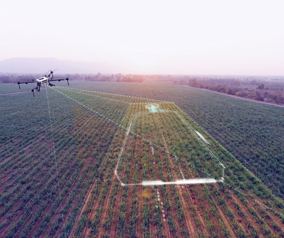
How Drone Mapping Helps Farmers
1. Field Health Monitoring
Drone-mounted cameras capture multispectral imagery that reveals crop stress not visible to the naked eye. Whether it’s pest damage, nutrient deficiency, or water issues, our drone maps help you spot problems early—before they impact your harvest.
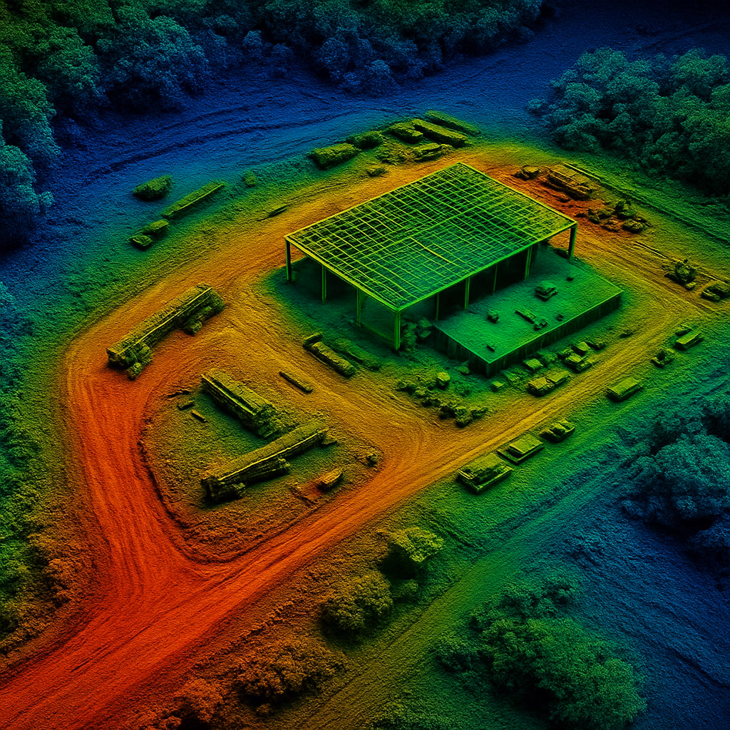
2. Accurate Field Mapping
Our aerial maps provide georeferenced data of every square foot of your land. With tools like NDVI analysis and elevation models, you can identify problem areas, fine-tune irrigation plans, and manage inputs more efficiently.
3. Optimized Spraying and Seeding
By identifying which areas of a field need more (or less) attention, farmers can apply chemicals or seed with pinpoint accuracy. This reduces waste, prevents over-application, and protects the environment.
4. Harvest Planning
Drone data also helps forecast yields and guide harvest logistics. With up-to-date maps and field performance data, you can schedule labor and equipment with confidence.
The SkyHound Advantage
SkyHound’s drone services give farmers access to the kind of high-resolution data that was once only available to large-scale operations. Our team delivers:
- Aerial imagery and mapping in as little as 24 hours
- Actionable insights tailored to your specific crop and terrain
- Easy-to-read reports and visualizations
- Expertise in drone spraying, NDVI analysis, and terrain modeling
Conclusion
Agriculture is evolving—and staying competitive means working smarter, not harder. With SkyHound’s drone mapping services, you get a detailed view of your farm from above, allowing you to make faster, more confident decisions.
Ready to take your yield to the next level? Contact us today to learn more about our drone solutions for agriculture.
other related articles


Get Your Own Drone – Elevate Your Capabilities
Take your operations to the next level with the latest in drone technology. Whether you're looking to capture high-quality aerial data, enhance your workflow, or explore new opportunities, we’ve got the perfect drone for you.