
What Happens During a SkyHound Deer Recovery Search?
11/12/2026
introduction
By SkyHound Drone Services
Calling a recovery service is easier when you know what information matters and what the search can realistically provide. At SkyHound, the process starts with your location and the facts you can share about the deer.
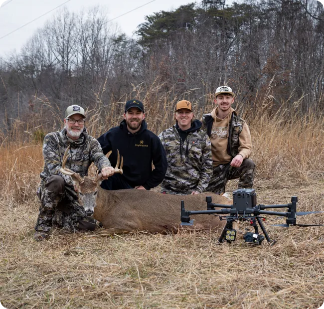
Here is what to expect when arranging a thermal drone deer recovery search with our Leesburg-based team.
The first call: establish the starting point
Have your property location, shot time, last known deer location and access information ready. Explain the direction the deer traveled and where the last confirmed sign was found. If other people have already searched, describe the area covered and any sightings.
We use that information to discuss the request and confirm availability. A county appearing in our service area does not mean every property can be flown immediately. Give us the exact location before traveling to meet the team.
Review the property and flight conditions
Before arranging a flight, we review the search area, weather, airspace and applicable requirements. Gates, launch access, boundaries and obstacles can affect the plan. Let us know about access questions early, including the possibility that the deer crossed onto neighboring land.
These details are particularly useful when requesting a search in Fairfax County or Montgomery County, where the exact property and surrounding area need to be assessed individually.
Search from the air
The drone's thermal imaging helps the operator look for possible deer locations. The search starts from the information available and is shaped by the terrain, visibility and feasible flight area. A thermal signal needs to be assessed; it is not automatically a confirmed recovery.
Cover can conceal part or all of an animal. Weather and temperature contrast also influence what can be distinguished. An aerial search adds a useful perspective, but it cannot guarantee that every part of a property is visible or that every deer will be detected.
Coordinate on the ground
If a downed deer is located, we share its position to help coordinate retrieval. Ground access remains an essential part of the process. Discuss boundaries and access arrangements before anyone enters neighboring property, and make sure the person coordinating the recovery can be reached by phone.
Finding a location on the display and physically reaching it are separate steps. A creek, steep bank or fence may affect the route even when the position itself is clear.
Keep expectations grounded in the result
Search duration and outcomes vary. SkyHound's published hunter experiences include both a successful recovery and a search that did not locate the buck. One customer's experience cannot predict another search.
If a deer is not found, that alone cannot establish whether it survived or left the property. Ask what the team was able to examine and what limited the search so you can understand the result.
Before you book
Review the service FAQ for pricing, call with the actual location, and confirm availability and the next steps with our team. Keep your map pins, timeline and access details together so the conversation can focus on your search.
Talk With SkyHound About Your Search
Call 703-772-1867 with your location to check search availability. SkyHound is based in Leesburg and accepts requests across Northern Virginia and Maryland, with West Virginia requests also welcome. Coverage, weather, airspace and access must be confirmed for each property.
Explore SkyHound drone deer recovery and FAQs or contact our team.
other related articles


Get Your Own Drone – Elevate Your Capabilities
Take your operations to the next level with the latest in drone technology. Whether you're looking to capture high-quality aerial data, enhance your workflow, or explore new opportunities, we’ve got the perfect drone for you.