Observed deer summary
A record of deer detected during the flight, with buck-and-doe classifications where imagery supports identification.
Thermal drone surveys for landowners and hunting clubs, with mapped deer observations, buck-and-doe counts where identification is possible, and a clear property report.
HIGH-RESOLUTION PROPERTY MAPPING
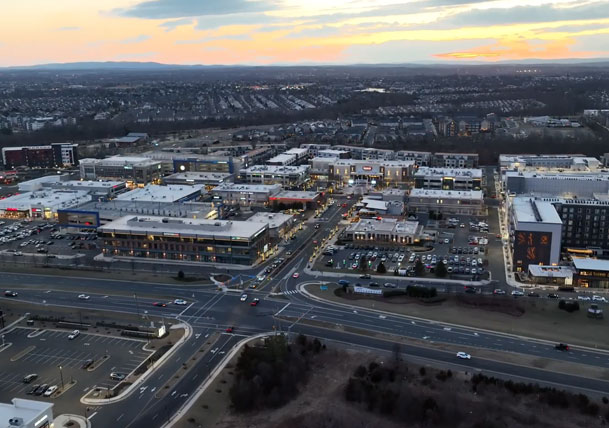
SkyHound maps your property by drone and delivers a high-resolution digital map you can zoom into and navigate, with numbered deer observation pins. Explore the relationship between observed deer, field edges, woodland and access routes—all in one property view.
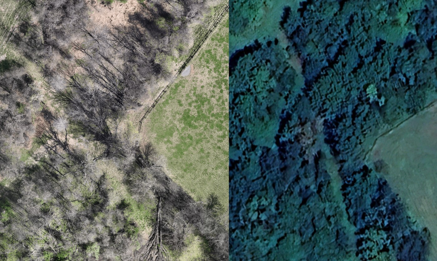
A real imagery example supplied by SkyHound. Select to enlarge. Capture dates, seasons and display scales may differ; this is an illustrative comparison, not a measured resolution test.
See how you can move across a property and zoom in to inspect the detail.
28-second screen recording of map navigation. This walkthrough shows the base imagery; survey observation pins are added to the delivered map.
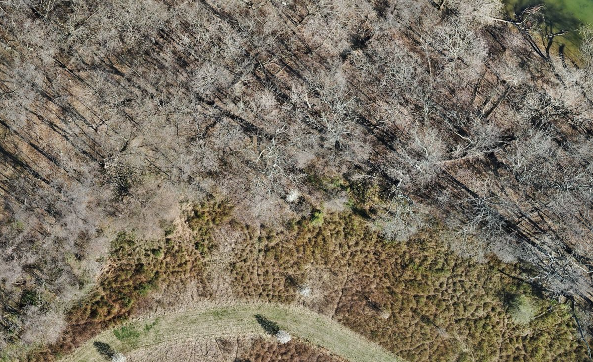
Examine visible field edges, openings and cover to help plan habitat improvements and ground visits. Keep a visual reference for future survey comparisons.
Pan across the map and zoom in to review areas that matter to you.
Numbered pins place deer observations in their property context alongside your survey findings.
Use the map and report together to guide habitat discussions and future monitoring.
We confirm mapping coverage, deliverables and pricing in your quote. Visible detail varies with vegetation, season and flight conditions.
SKYHOUND / SAMPLE FIELD RESULTS
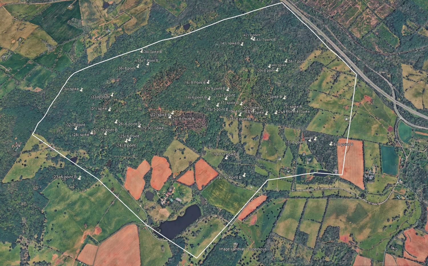
Explore a sample report from a 1,200-acre Virginia property, with mapped observations and individual buck photographs that turn aerial survey findings into a useful reference for landowners.
Survey date: December 10, 2025. These are recorded survey observations, not a verified count of every deer living on the property.
Review the survey summary, observed buck-to-doe ratio, numbered observation map, example buck photographs and management discussion.
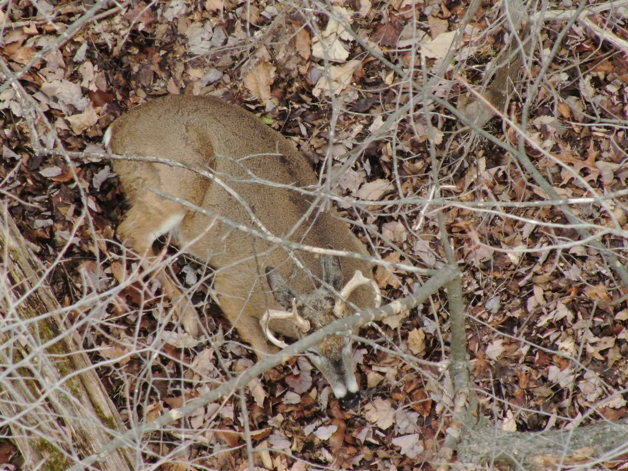
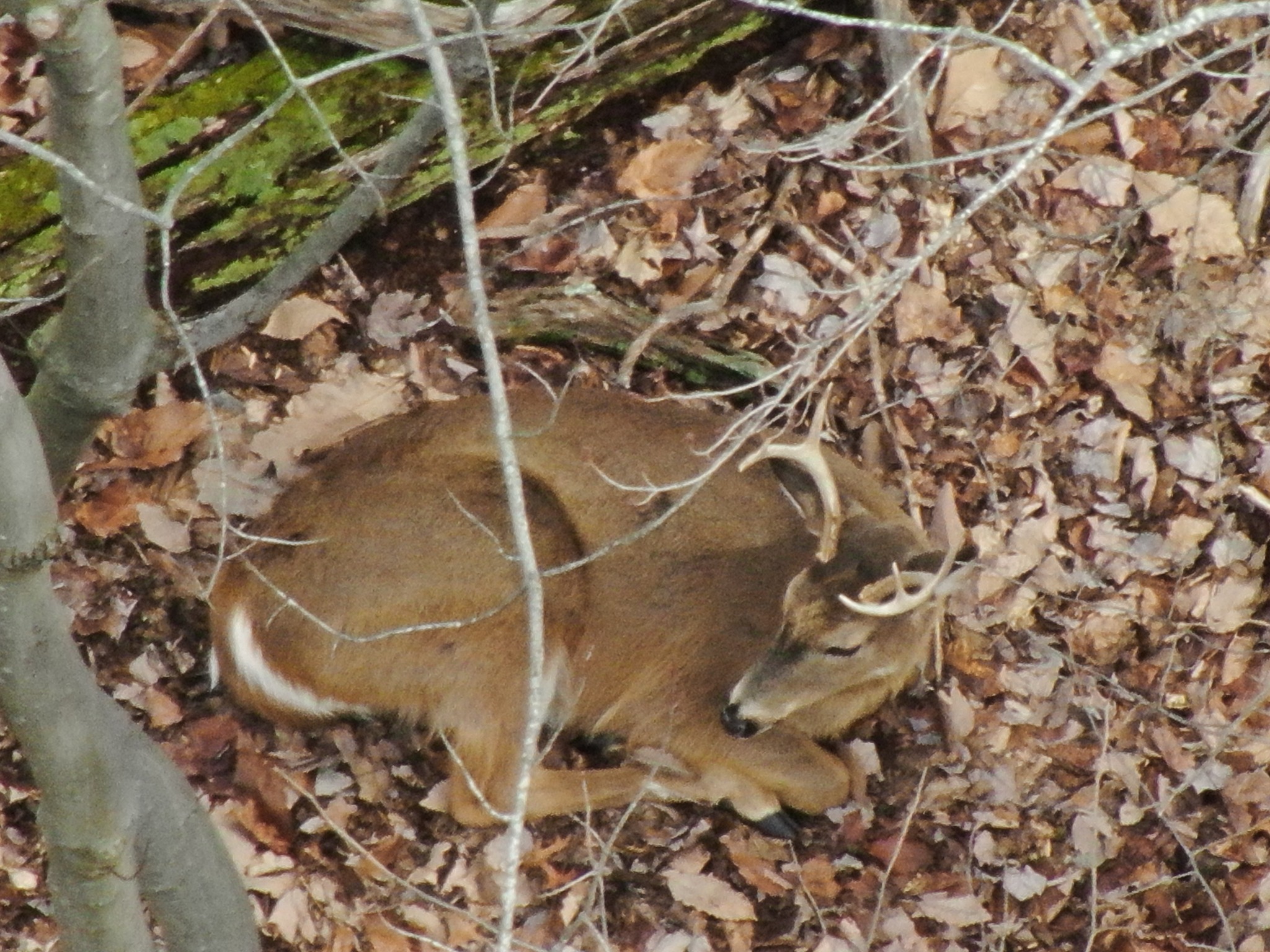
Two individual buck photographs supplied with the sample survey.
Numbered pins identify individual buck observations. The white outline marks the surveyed property boundary.
Existing customer reviews of SkyHound’s deer recovery and general service. These are not testimonials about the sample herd survey.
“Had a great experience with Sky hound with their deer recovery service. They had a very rapid response and was able to make it to me right away. They have top of the line equipment and the customer service was unmatched.”
“Tyler has great drone experience and is a wonderful guy as well. He will do quality work for you”
“Incredible images and customer service! I would highly recommend.”
FROM OBSERVATIONS TO A USEFUL PROPERTY RECORD
We agree on the survey area and deliverables with you before booking. The sample above shows how observations can be organized into a clear report.
A record of deer detected during the flight, with buck-and-doe classifications where imagery supports identification.
Observation locations shown against your property, so you can review where deer were detected during the survey.
Relevant photographs and survey limitations, with image availability depending on visibility and flight conditions.
Pricing depends on acreage, location and travel, terrain, airspace requirements and the deliverables you choose. We confirm the survey scope, price and expected report turnaround before you book.
Share your Virginia county and approximate acreage to start. We will confirm your survey and interactive property mapping scope in your quote.
Get My Deer Survey QuoteSkyHound founder Tyler Richards is based in Leesburg, Virginia, with more than 10 years of drone experience and over 20 years of hunting experience. His background includes work at DJI and operating in restricted airspace.
FAA Part 107 certification, careful flight planning and practical hunting experience inform how SkyHound approaches each property.
Talk with SkyHound: 703-772-1867Your quote depends on surveyed acreage, location and travel, terrain, airspace requirements and the agreed deliverables. Send your county and approximate acreage so we can confirm a price before you book.
Tell us your approximate acreage and whether adjoining properties can be included with permission. We’ll assess whether a survey is practical and useful for your property and goals before scheduling.
Ask about availability ahead of your management planning season. We choose suitable flight conditions based on vegetation, weather and thermal visibility; a planned flight may need to move if conditions are unsuitable.
Thermal imagery can help locate deer visible through gaps in cover, but it cannot see through solid vegetation. Dense canopy, terrain and other obstructions can hide animals. We discuss these limitations when assessing your property.
No. Results describe deer observed during the survey. Classification is made where imagery supports it, and repeat observations must be considered. The report is not a guaranteed census of every resident deer.
The agreed scope can include an observed-deer summary, buck-and-doe classifications where possible, mapped observation locations and supporting imagery. We confirm your deliverables and expected report turnaround in your quote before booking.
We coordinate access, property boundaries and landowner permission before the flight. We’ll discuss whether your presence is needed and any site-specific access arrangements.
Use the report alongside trail-camera records, habitat observations and harvest history to inform management discussions. A single survey does not establish seasonal migration, herd health or a scientifically justified harvest quota.
Start with your county, acreage and goals. We’ll help you determine whether a thermal drone survey is a good fit.

Review where deer were observed during the survey and how detections relate to your property.
Where imagery permits, identify visible bucks and does. Not all deer can be classified or detected.
Survey planning accounts for acreage, property boundaries, access, weather and applicable airspace requirements.

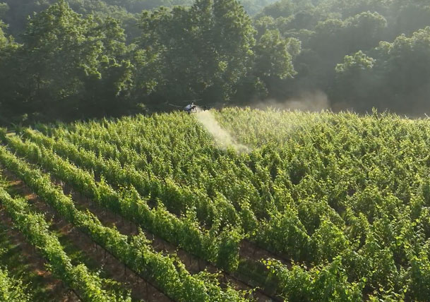
From drone-powered crop spraying to large-scale property mapping, our advanced UAV technology enhances agricultural efficiency, reduces waste, and maximizes yields with data-driven insights.
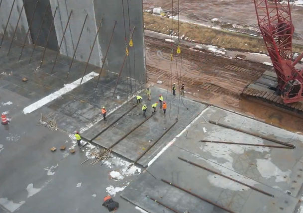
Streamline your construction projects with high-accuracy mapping, LIDAR scanning, and aerial progress monitoring. Our drone solutions provide real-time data for better planning, efficiency, and cost control.
Whether you need property mapping, herd analysis, or terrain visualization, our drone technology helps you manage land with precision, offering data-driven insights for outdoor industries.
Elevate your brand or event coverage with high-quality aerial photography and videography. Whether it’s for marketing, real estate, or documentary filmmaking, our drones deliver cinematic visuals with unparalleled precision.
From drone-powered crop spraying to large-scale property mapping, our advanced UAV technology enhances agricultural efficiency, reduces waste, and maximizes yields with data-driven insights.
Streamline your construction projects with high-accuracy mapping, LiDAR scanning, and aerial progress monitoring. Our drone solutions provide real-time data for better planning, efficiency, and cost control.
Whether you need property mapping, herd analysis, or terrain visualization, our drone technology helps you manage land with precision, offering data-driven insights for outdoor industries.

Elevate your brand or event coverage with high-quality aerial photography and videography. Whether it’s for marketing, real estate, or documentary filmmaking, our drones deliver cinematic visuals with unparalleled precision.


Lorem ipsum dolor sit amet, consectetur adipiscing elit. Suspendisse varius enim in eros elementum tristique. Duis cursus, mi quis viverra ornare, eros dolor interdum nulla, ut commodo diam libero vitae erat.
Acres mapped
Of acres flow for agriculture clients
Lorem ipsum dolor sit amet, consectetur adipiscing elit. Suspendisse varius enim in eros elementum tristique. Duis cursus, mi quis viverra ornare, eros dolor interdum nulla, ut commodo diam libero vitae erat.
Acres mapped
Of acres flow for agriculture clients
Lorem ipsum dolor sit amet, consectetur adipiscing elit. Suspendisse varius enim in eros elementum tristique. Duis cursus, mi quis viverra ornare, eros dolor interdum nulla, ut commodo diam libero vitae erat.
Acres mapped
Of acres flow for agriculture clients
I shot a buck with a crossbow and didn’t have luck finding it. I called Tyler and he was out within hours!!! We searched 10X what I could do on foot and with no disturbance to other deer. We were unfortunately not able to recover the deer but it was nice to know I did everything I could to recover it and that it may survive. 1000% recommend this service.
Had a great experience with Sky hound with their deer recovery service. They had a very rapid response and was able to make it to me right away. They have top of the line equipment and the customer service was unmatched.
SkyHound, my next-door neighbor, so I know Tyler and trust him, did a fantastic job of thermal-assessment of my 1899 colonial, that will help me improve my house's thermal integrity. I highly recommend SkyHound!
Tyler has great drone experience and is a wonderful guy as well. He will do quality work for you
I’ve been hunting for 50 years and have regretfully not found deer that I hit with my bow. This year I used SkyHound the day after shooting a deer an was unable to find it. The SkyHound guys found it in 20 minutes. I’m a SkyHound believer!!
Incredible images and customer service! I would highly recommend.
I shot a buck with a crossbow and didn’t have luck finding it. I called Tyler and he was out within hours!!! We searched 10X what I could do on foot and with no disturbance to other deer. We were unfortunately not able to recover the deer but it was nice to know I did everything I could to recover it and that it may survive. 1000% recommend this service.
Had a great experience with Sky hound with their deer recovery service. They had a very rapid response and was able to make it to me right away. They have top of the line equipment and the customer service was unmatched.
SkyHound, my next-door neighbor, so I know Tyler and trust him, did a fantastic job of thermal-assessment of my 1899 colonial, that will help me improve my house's thermal integrity. I highly recommend SkyHound!
Tyler has great drone experience and is a wonderful guy as well. He will do quality work for you
I’ve been hunting for 50 years and have regretfully not found deer that I hit with my bow. This year I used SkyHound the day after shooting a deer an was unable to find it. The SkyHound guys found it in 20 minutes. I’m a SkyHound believer!!
Incredible images and customer service! I would highly recommend.
Discover how our advanced drone technology enhances efficiency, accuracy, and innovation across industries—providing reliable data and actionable insights for your business.
What industries benefit from your drone services?

We provide drone solutions for agriculture, construction, outdoor management, and media production, offering specialized services tailored to each industry’s unique needs.
How accurate is drone mapping and surveying?
Our drone technology delivers precise measurements with sub-centimeter accuracy, ensuring highly reliable data for mapping, volumetric scans, and topographical assessments.
Can drones be used for environmental monitoring and land management?
Yes! Our drones assist in land surveying, crop health analysis, wildlife tracking, and property assessments, providing cost-effective and environmentally friendly solutions.
Do you offer custom drone solutions?
Absolutely. We work closely with clients to develop tailored drone service packages that align with their specific project requirements and objectives.
How do I get started with SkyHound’s drone services?
Simply contact us for a consultation! We’ll discuss your needs, recommend the right services, and provide a detailed quote to get your project off the ground.
Sign up for our mailing list to receive important updates, special offers, and the latest on drone technology solutions!